+91-9816098702 intowildhimalaya@gmail.com
Fixed Departure 2026
From$1,989$1,900
Fixed Departures
Enquiry Form
Full Name*
Email Address*
Travel Date*
People*
Your Enquiry*
* I agree with Terms of Service and Privacy Statement.
Please agree to all the terms and conditions before proceeding to the next step
August 1, 2026
* Please select all required fields to proceed to the next step.

Book Now

Save To Wish List

Adding item to wishlist requires an account

471

Got a Question?

Do not hesitage to give us a call. We are an expert team and we are happy to talk to you.

+91-9816098702

intowildhimalaya@gmail.com

Trekkers at a high-altitude campsite on the Pin Parvati Pass Trek in the Himalayas with snow, mountains, and tents.

Pin Parvati Pass Trek | Himalayan Trekking Expedition in India

  • Duration19 Days
  • Max. Group Size12
  • DifficultyDifficult
  • Highest Point5319 m (17,450 ft.)

Pin Parvati Pass Trek India – Himalayan Trekking Expedition

The Pin Parvati Pass Trek India is one of the most iconic and challenging Himalayan expeditions, connecting the lush Parvati Valley with the stark high-altitude desert of Spiti. This demanding journey includes glacier crossings, steep ascents, river fords, and rugged terrain that shifts dramatically from green forests to barren mountain landscapes.

Trekkers explore remote villages, alpine meadows, ancient shepherd trails, and the wild beauty of Pin Valley National Park. With certified guides, structured acclimatization, and full expedition support, this trek offers a rewarding and unforgettable high-altitude Himalayan experience for seasoned trekkers seeking a true trans-Himalayan challenge.

HIGHLIGHTS:
⭐ Classic trans-Himalayan crossing: Parvati Valley to Pin Valley
⭐ Summit Pin Parvati Pass (5,319 m / 17,451 ft)
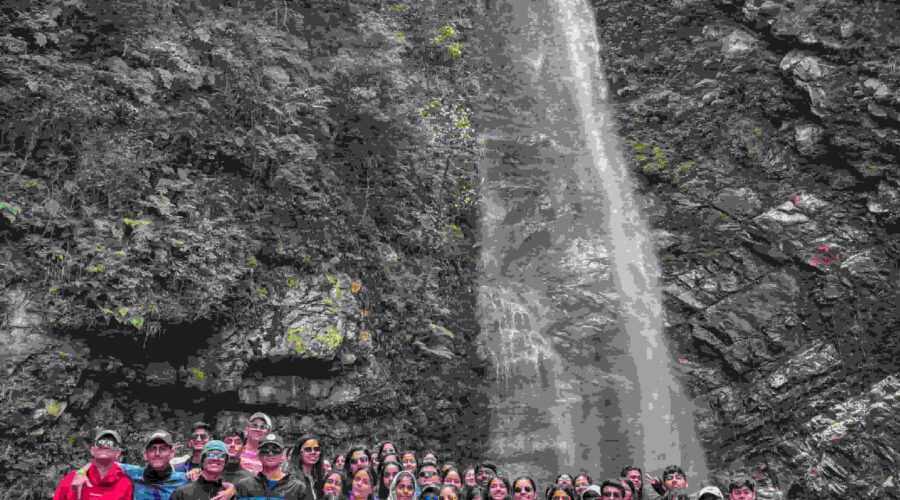
⭐ Relax at Kheerganga hot springs & camp at Mantalai Lake
⭐ Explore Pin Valley National Park’s wildlife & landscapes
⭐ Visit remote Spiti villages with Buddhist culture
⭐ Dramatic shift from forest trails to Himalayan desert
⭐ Fully guided expedition for seasoned trekkers

Travel Information

Recommended Airport

Indira Gandhi International Airport (New Delhi)

Recommended Railway Station

Insert Nearest Railway Station

Recommended Bus Stand

Insert nearest bus stand

Meeting Point

Pick up from New Delhi airport

Gallery
Itinerary
Map
Package Details

Inclusions

All airport transfers from/from Delhi T3 and arranged domestic flights/transfers as per itinerary

All meals during the trek (vegetarian + eggs; tailored dietary support on request)

Accommodation in hotels, camps, and village homestays as per itinerary

Professional mountain guides and support staff (Guide:Client 1:6), cooks and porters

High-quality camping equipment (tents, sleeping mats, cooksets)

Group technical gear (ropes, microspikes, basic high-altitude kit)

Permits, park fees, and liaison officer charges where applicable

First-aid kit, oxygen cylinder, evacuation support coordination

Domestic flight: Delhi to Kullu and Chandigarh to Delhi

Exclusions

Package Price does not include which is not mentioned in the inclusion list.

International Flights

Personal trekking gear

Travel insurance and emergency evacuation insurance (mandatory)

Meals during road transfers not included explicitly

Personal expenses, tips, telephone, laundry, and items of personal nature

Costs due to route changes or delays caused by weather or authorities

Things you need to carry

Clothing & Layers
• 2–3 thermal base layer tops
• 2 thermal bottoms
• 1–2 fleece jackets
• 1 down jacket (rental available)
• Waterproof jacket
• Waterproof pants
• 2–3 trekking trousers
• Warm track pant for camp
• Inner sleeping socks

Footwear
• Waterproof high-ankle trekking shoes (rental available)
• Lightweight camp sandals
• 4–5 pairs woollen socks
• 2 pairs synthetic socks

Head & Hand Gear
• Sun cap
• Warm beanie
• Neck gaiter or balaclava
• Inner fleece gloves
• Waterproof outer gloves

Bags & Gear
• 50–60L backpack with rain cover (rental available)
• 20–30L daypack
• Trekking poles (rental available)
• Headlamp with spare batteries (rental available)

Hydration & Snacks
• 2 water bottles (1L each) or hydration bladder
• Water purification tablets
• Energy bars, nuts, electrolyte powders

Personal Items
• Biodegradable soap and toiletries
• Quick-dry towel
• Wet wipes and hand sanitiser
• Toilet roll
• Sunglasses (UV protection)
• Sunscreen SPF 50+
• Lip balm SPF 30+

Health & Safety
• Personal medications
• Basic first-aid kit
• Painkillers and band-aids
• Blister care kit
• Diamox (consult doctor)
• ORS/electrolytes

Documents & Money
• Government ID or passport
• Copies of permits (provided)
• Cash for remote regions (ATMs limited)

Electronics
• Power bank 10,000–20,000 mAh
• Camera or action cam and extra batteries
• Charging cables and adapters

Optional Items
• Backpack liner
• Compact thermos
• Small repair/sewing kit
• Personal journal

First Aid Kit

First Aid Kit for Trekking

1. Wound Care & Dressings

• Adhesive bandages (multiple sizes)
• Sterile gauze pads
• Crepe elastic bandage
• Medical adhesive tape
• Antiseptic wipes
• Antiseptic liquid or cream
• Cotton rolls and cotton swabs
• Butterfly closures
• Steri-strips (if available)

2. Blister & Foot Care

• Blister pads (Compeed or moleskin)
• Anti-friction tape
• Toe separators (optional)
• Small scissors for tape/moleskin

3. Pain Relief & Anti-Inflammatory

• Paracetamol
• Ibuprofen
• Anti-inflammatory tablets
• Pain-relief spray or muscle gel
• Hot/cold gel pack (optional)

4. Gastrointestinal & Hydration Support

• Anti-diarrheal tablets
• Antacid tablets
• Oral Rehydration Salts (ORS)
• Electrolyte powders
• Activated charcoal (optional)

5. Altitude & Respiratory Support

• Diamox (consult doctor before use)
• Cough lozenges
• Steam-inhalation capsules (optional)
6. Allergy & Skin Care

• Anti-allergy tablets
• Hydrocortisone cream
• Aloe vera gel
• Lip balm with SPF
• Sunscreen SPF 50+
• Lubricating eye drops

7. Tools & Hygiene Essentials

• Digital thermometer
• Tweezers
• Small medical scissors
• Disposable medical gloves
• Face masks (N95 or medical)
• Hand sanitiser
• Mini soap or hand wash
• Waste-disposal zip bags

8. Personal Medications

• Personal prescription medicines
• EpiPen (if required)
• Any doctor-advised specific medication

Note: Into Wild Himalaya always carries a comprehensive expedition-grade First Aid Kit along with an oxygen canister for all high-altitude treks. However, we strongly encourage every participant to carry a small, personal first aid kit for individual comfort and quick access during the trek.

Cancellation Policy

For details on our cancellation policy, please refer to the following link:
https://iwhexpeditions.com/cancellation_policy/

Day 1Arrival in Delhi

Max Altitude: 216 m (709 ft)

Arrive at Delhi’s Indira Gandhi International Airport (T3), where our team meets you for a welcome briefing and final documentation check. This day is intentionally relaxed to let participants recover from international or domestic travel and to regroup before the mountain portion begins. You’ll receive a detailed safety and equipment orientation, meet your lead guide, and confirm logistics for the onward flight to Manali. We also review acclimatisation strategy, emergency procedures, and environmental protocols so every trekker starts informed and confident. Evening is for rest and final packing.

Day 2Flight: Delhi to Manali

  • Driving Time: Transfer time to airport approx. 20 Mins in Delhi
  • Max Altitude: 2,050 m (6,726 ft) Manali
  • Altitude Gain: +1,834 m
    Board the flight or organized road transfer to Manali a mountain town that serves as your launch point into the Parvati Valley. On arrival you’ll check into your hotel, conduct a final gear check with our guides, and attend a technical briefing covering route specifics, weather expectations, and high-altitude health measures. The remainder of the day is for light acclimatisation: short walks, hydration, and rest. Eating well and sleeping early is encouraged; the aim is to build a steady foundation for the challenging days ahead.

Day 3Manali to Barshaini and Trek to Kheerganga

  • Driving Time: Manali to Barshaini: 4–5 hrs (approx. 90 km)
  • Trekking Time: 3 to 4 hr
  • Max Altitude: 2,300 m (7,600 ft) — Kheer ganga
  • Altitude Gain: +250 m (from Manali)
    After a scenic drive through apple orchards and pine forests, arrive at Barshaini and begin the short, welcoming trek to Kheer ganga. The trail winds along the Parvati River, passing waterfalls, wooden bridges, and small hamlets. Kheer ganga is famous for its natural hot springs an ideal place to soothe muscles after travel and the drive’s bumpy roads. This short first day is about settling into trail rhythm, enjoying the valley scent of cedar and wildflower meadows, and listening to your guide explain the terrain and acclimatisation plan for the days ahead.

Day 4Kheerganga to Tunda Bhuj

  • Trekking Time: 7–8 hrs (approx. 13 km)
  • Max Altitude: 3,350 m (11,000 ft)  Tunda Bhuj
  • Altitude Gain: +1,050 m (from Kheer ganga)
    Today’s full trekking day is your first major altitude gain and introduces the austere, open landscapes that define the upper Parvati Valley. The trail climbs progressively through rhododendron and birch zones before opening into high alpine meadows. You’ll cross cascade-fed streams and rocky sections; the changing vegetation signals increasing altitude. Tunda Bhuj’s expansive pasturelands offer dramatic panoramic views and an opportunity for careful, deliberate pacing. Guides emphasize consistent hydration and walking rhythm today, and the campsite’s broad vistas at sunset reward your effort with an unforgettable Himalayan panorama.

Day 5Tunda Bhuj to Thakur Kuan

  • Trekking Time: 6–7 hrs (approx. 11 km)
  • Max Altitude: 3,550 m (11,650 ft)  Thakur Kuan
  • Altitude Gain: +200 m (from Tunda Bhuj)
    This day blends varied terrain scree, meadow, and stream crossings as the trail winds toward Thakur Kuan. You’ll pass seasonal grazing zones, stone cairns, and small shepherd camps, which reveal the area’s pastoral life. The path demands attention on boulder sections and wooden bridges, but offers generous views of surrounding ridgelines. At Thakur Kuan, the campsite provides shelter and time to practice breathing techniques and basic altitude coping strategies taught by guides. Cultural notes on local Parvati Valley life and environmental stewardship are shared during camp briefings.

Day 6Thakur Kuan to Odi Thach

  • Trekking Time: 5–6 hrs (approx. 9 km)
  • Max Altitude: 3,800 m (12,400 ft) Odi Thach
  • Altitude Gain: +250 m (from Thakur Kuan)
    Today’s route continues through classic Parvati highlands, offering gentler walking interspersed with short climbs. The valley widens and you’ll notice the tree line thinning as alpine grasses and rocky outcrops dominate. Odi Thach is known for its quiet expanses and stellar views of snow-sheathed ridges. This day is ideal for consolidating acclimatisation: steady pace, regular snack breaks, and group check-ins. Guides will review rope and glacier-safety basics in preparation for higher, more technical sections, while evening conversation centres on local mountain lore and the significance of Mantalai Lake ahead.

Day 7Odi Thach to Mantalai Lake

  • Trekking Time: 7–8 hrs (approx. 12 km)
  • Max Altitude: 4,150 m (13,600 ft) Mantalai Lake
  • Altitude Gain: +350 m (from Odi Thach)
    The climb to Mantalai Lake is a step into a high glacial basin the landscape becomes rockier and the air perceptibly thinner. Approaching the lake, vegetation gives way to scree and exposed ridgelines. Mantalai is not only scenically spectacular but culturally revered as the Parvati River’s source; pilgrims sometimes perform rituals here. The campsite beside the lake offers profound stillness and excellent sunrise/sunset light for photographers. Guides emphasize rest, checking for mild altitude symptoms, and ensuring everyone is comfortable with the final summit push’s technical demands.

Day 8Mantalai Lake to Summit Camp

  • Trekking Time: 7–8 hrs (approx. 11 km)
  • Max Altitude: 4,950 m (16,300 ft) Summit Camp
  • Altitude Gain: +800 m (from Mantalai)
    This is a difficult and technical day as you leave lake environs for steeper moraine fields and glacier-approach terrain. The gradient increases and you will move across varied surfaces — loose scree, snow patches, and rocky steps. Summit Camp is positioned to give the best possible acclimatisation before the pass attempt; its exposure to weather underlines the importance of preparedness. Guides review crampon use, roped travel, and high-altitude safety. Evenings are deliberately calm and early, focusing on calorie-rich meals and adequate sleep to prime the body for the pass crossing.

Day 9Summit Camp over Pin Parvati Pass (5,319 m) and Pin Base (Bedu Thach)

  • Trekking Time: 10–12 hrs (approx. 15 km including ascent & long descent)
  • Max Altitude: 5,319 m (17,451 ft) — Pin Parvati Pass; Pin Base 4,450 m (14,600 ft)
  • Altitude Gain/Loss: Gain +369 m (Summit Camp to Pass), Loss −869 m (Pass to  Pin Base)
    The pass day is the trek’s pinnacle: a demanding early-morning ascent to the Pin Parvati Pass, followed by a long descent into Pin Valley. Expect steep snow slopes, wind-exposed ridgelines, and technical sections requiring teamwork, fixed lines, or rope support depending on conditions. The summit rewards you with astonishing 360° panoramas where lush Kullu meets Spiti’s barren plains. The descent is long and tests knees and focus; approach to Pin Base reveals the stark beauty of the trans-Himalaya and signals the dramatic ecological shift you’ve earned by crossing the pass.

Day 10Pin Base (Bedu Thach) to Tiya

  • Trekking Time: 5–6 hrs (approx. 12 km)
  • Max Altitude: 3,950 m (13,000 ft) Tiya
  • Altitude Gain/Loss: −500 m 
    After the pass the landscape opens into Pin Valley National Park — a protected area known for rare fauna such as snow leopards and Bharal (blue sheep). Today’s descent is gentler and offers panoramic views of layered mountains and multicoloured strata. Enjoy a calmer walking rhythm and observe how vegetation and human settlement patterns change with the rain shadow effect. Tiya’s meadows and clear light provide a restful campsite where the team can debrief the crossing, care for feet and gear, and prepare for the last trail segment to Mud village.

Day 11Tiya to Mud

  • Trekking Time: 4–5 hrs (approx. 12 km)
  • Max Altitude: 3,810 m (12,500 ft) Mud
  • Altitude Gain/Loss: −140 m
    This concluding trekking day is a rewarding blend of cultural interaction and relaxing trail time. The route descends to Mud a small, traditional Spitian village where terraced fields, whitewashed homes, and Buddhist prayer flags greet trekkers. Arriving in Mud feels like a milestone: you’ve completed a dramatic trans Himalayan crossing. Engage with local villagers to learn about their mountain agriculture and customs, and enjoy the comfort of a village-style campsite or homestay. This day offers lovely photographic opportunities and time to feel the accomplishment of the entire expedition.

Day 12Drive: Mud to Manali

  • Driving Time: 6–7 hrs (approx. 210 km)
  • Max Altitude: 2,050 m (6,726 ft) Manali
  • Altitude Gain/Loss: −1,760 m
    Trade walking boots for a scenic drive back toward Manali. The route traces high mountain roads through Kaza and dramatic gorges, offering last views of Spiti’s desert plateaus and isolated monasteries. Expect long but visually rewarding driving; the contrast between Spiti and Kullu is remarkable and reinforces the trans-Himalayan nature of the trek. On arrival in Manali you’ll have time for hot showers, laundry, and a celebratory meal. The evening is for packing, sharing photos and reflections, and beginning the logistics to return to Delhi.

Day 13Manali to Chandigarh and Flight to Delhi

  • Driving Time: Manali to Chandigarh 5-6 hrs (approx. 310 km)
  •  Flight to Delhi Flying time: 1h:15 Min
  • Max Altitude: 216 m (709 ft) Delhi arrival
  • Altitude Gain/Loss: −1,834 m
    Drive to Chandigarh for your scheduled flight to Delhi (or direct transfers as arranged). This final travel day provides time to decompress, exchange contact details, and complete any outstanding admin. Our team assists with transfers and ensures your onward travel is smooth. Reflect on the crossing and the friendships formed; this day acts as a gentle reintroduction to the plains. On arrival to Delhi you will be transferred to your hotel.

Day 14Flight: Departure to Home

  • Driving Time: Hotel to Airport (variable: 15-25 minutes depending on location)
  • Max Altitude: 216 m (709 ft) Delhi
  • Altitude Gain/Loss: Minimal
    Today marks the conclusion of your Pin Parvati Pass Trek – Himalayan Trekking in India adventure. After breakfast, you will be transferred to the airport for your international or domestic flight home. Our team ensures a smooth check-out and timely arrival at the airport so your departure is stress-free. This is a day to reflect on the incredible landscapes you’ve crossed from Parvati’s deep forests to the high Himalayan pass and the remote villages of Spiti. You return home carrying memories, personal achievements, and the deep satisfaction of completing one of India’s most iconic high altitude trek.

Day 15Journey to Tabo and Dhankar

Altitude: 3550 m / 11,646 ft.
The Tabo Gompa – founded in 966 AD – has exquisite frescoes and statues; oftenly called the Ajanta of the Himalayas. Dhankar, the ancient capital of the Spiti King , has the most incredibly situated Gompa; perched high on the barren rocky mountain slopes. Later in the day we will continue to Kaza, which is the Spiti divisional headquarters. Overnight in the camp.

Day 16Journey to Kye and Kibber then back to Kaza

Altitude: 4200 m / 13,779 ft.
We will leave to visit the famous Kye Gompa that is perched high on a pyramid-like mountain, which belongs to the Gelugpa sect of Tibetan Buddhism. Kibber, one of the highest permanent inhabited villages, is located in a semi bowl-shaped landscape. We will visit a small Gompa before returning to the camp near Kaza.

Day 17Journey from Kaza to Manali

Travelling Distance: 190 km
As we drive through several villages of Spiti, passing over the Kunzum Pass (4700 m / 15,419 ft.) you will experience the magnificent views of the Himalayan Peaks. We will then drive through Chandra Valley, then uphill to Rohtang Pass (3950 m / 12,959 ft.) which provides the main gate way of Lahaul-Spiti and Kullu. We will then descend to Manali. Overnight stay in hotel.

Day 18Journey from Manali – Delhi: Explore Manali

Travelling Distance: 570 km
Travelling Time: 16 hours
Free visit in Manali. You will be able to spend the rest of the day freely within the town until 3pm, when you will depart for the bus station. Overnight journey in comfortable bus.

Day 19Flight Departure: Delhi

You will be given the opportunity to explore around Delhi as you will have a full day free, before being transferred to the Indira Gandhi International Airport where you will depart to your onward destination.

FAQ

Who operates the Pin Parvati Pass Trek India?

The trek is operated by Into Wild Himalaya, a certified Himalayan adventure and expedition company specialising in guided trekking and mountaineering programs across India’s high-altitude regions.

Are the guides experienced for high-altitude technical trekking routes?

Yes all departures are led by certified Himalayan Trek Leaders, Wilderness First Responders, and experienced regional support staff trained in navigation, altitude safety, and technical terrain management.

Why should I choose Into Wild Himalaya for this expedition?

We focus on professional leadership, reliable logistics, responsible pacing, and safe decision-making. Our approach includes:

  • Certified leadership

  • Cultural sensitivity

  • Emergency readiness

  • Acclimatization-aware itinerary

  • Small group expedition style

What is cancellation policy?

A wonderful serenity has taken possession of my entire soul, like these sweet mornings of spring which I enjoy with my whole heart. I am alone, and feel the charm of existence in this spot, which was created for the bliss of souls like mine. I am so happy, my dear friend, so absorbed in the exquisite.

Is the trek safe?

Safety is our highest priority. We use a structured acclimatization approach, weather-based decision making, route awareness, and professional guidance. Risk management and communication systems are part of every expedition.

Are you affiliated with official adventure tourism bodies?

Yes Into Wild Himalaya is associated with:

  • ATOAI — Adventure Tour Operators Association of India

  • ATOAHP — Adventure Tour Operators Association of Himachal Pradesh

  • ATOAM — Adventure Tour Operators Association of Manali

These affiliations support industry standards, ethical trekking practices, and operational accountability.

Do you follow ethical and sustainable trekking practices?

Yes. We follow Leave No Trace principles, support local communities, work with regional teams, and protect fragile Himalayan environments.

When is the best time of year to trek the Pin Parvati Pass?

The best season for the Pin Parvati Pass Trek is typically from July to early September, when the route becomes accessible after snowmelt. This window offers the safest weather, better visibility, and stable conditions for high-altitude travel.

How does the Pin Parvati Pass Trek compare to other Himalayan trekking routes?

The Pin Parvati Pass Trek is considered one of the most challenging and diverse Himalayan trekking routes in India. Unlike shorter or easier treks, it offers major landscape transitions, a high-altitude pass, glacier crossings, and remote wilderness making it ideal for experienced trekkers seeking a demanding and rewarding expedition.

Is the Pin Parvati Pass Trek suitable for international travellers?

Yes. International trekkers regularly join this expedition. The trek includes reliable communication, planned acclimatization, professional guide support, and pre-arrival assistance to make travel planning simple and stress-free for travellers coming from abroad.

What kind of weather should I expect during the trek?

Expect a wide range of conditions, from warm valley temperatures to cold, windy conditions near the pass. Weather can change quickly at high altitude, so trekkers must be prepared for sun, snow patches, wind, and low temperatures, especially during early mornings and summit day.

What gear or equipment do I need for the Pin Parvati Pass Trek?

A high quality backpack, layered clothing, waterproof gear, trekking shoes, headlamp, gloves, sunglasses, and sleeping essentials are required. Once you register, we share a complete and detailed packing list to help you prepare correctly.

Can this trek help me prepare for future Himalayan mountaineering expeditions?

Yes. The Pin Parvati Pass Trek is often considered a stepping stone for more technical Himalayan climbs, thanks to its altitude, terrain variation, glacier exposure, and endurance requirements.

Is acclimatization included in the itinerary?

Yes. Acclimatization and gradual pacing are built into the itinerary to reduce altitude-related risks and help trekkers adjust safely to higher elevations.

Where can I explore more Himalayan trekking routes?

Where can I learn more about the Spiti region of this trek?

For regional insights, visit:
https://en.wikipedia.org/wiki/Spiti

What makes the Pin Parvati Pass Trek unique?

It crosses from green forests to a high-altitude desert in a single route—one of the Himalayas’ most dramatic landscape transitions.