
Access, permits and road conditions in eastern Ladakh change frequently — confirm the current position before travelling.
Umling La has become one of the most recognisable names in high-altitude motorcycle travel in Ladakh. At 5,798.251 metres (19,024 feet), the pass became famous for its extreme elevation and for the Border Roads Organisation’s achievement in building the Chisumle–Demchok road in one of the most remote parts of eastern Ladakh.
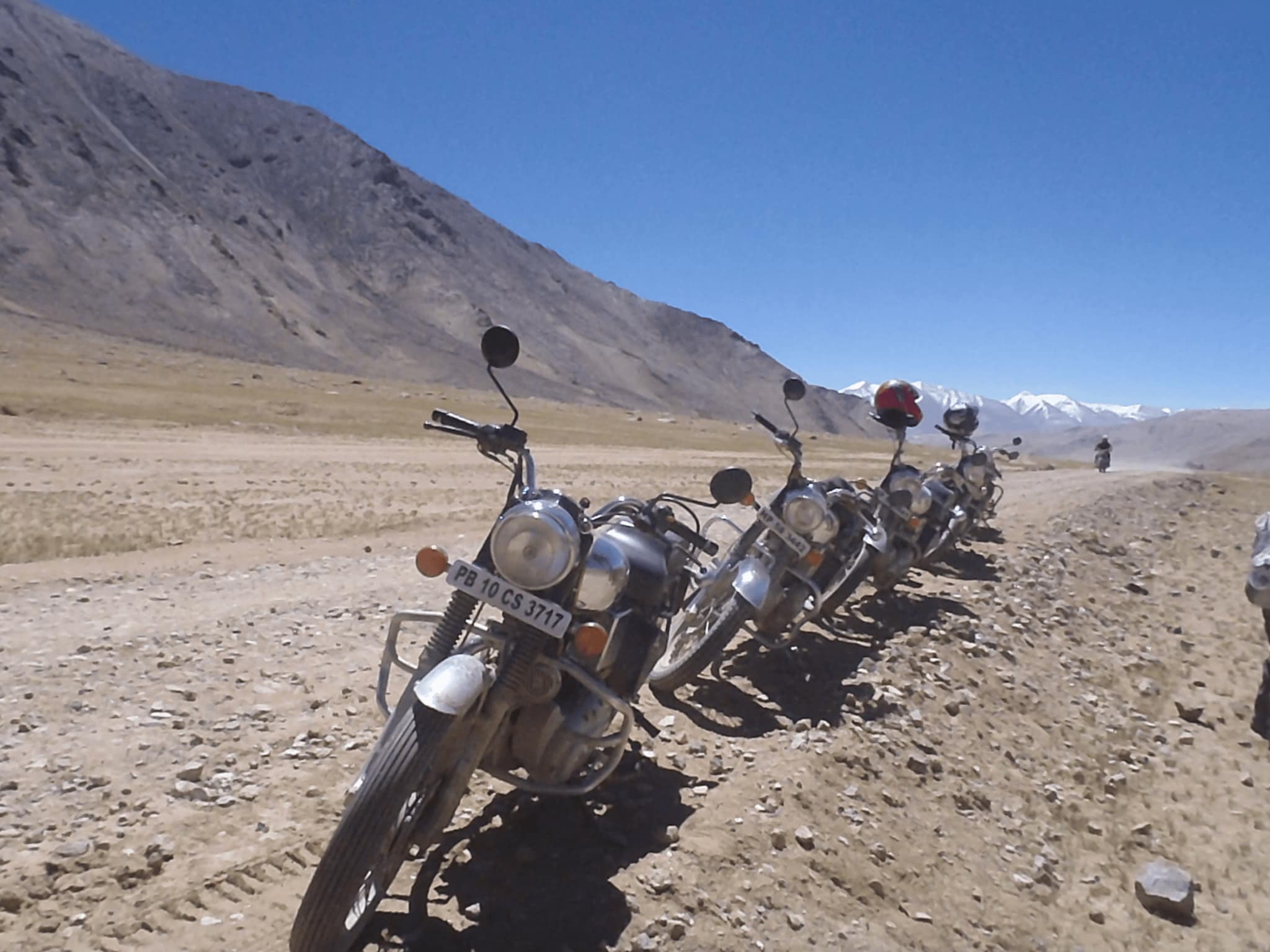
For motorcycle travellers, however, the significance of Umling La is not simply the number on the signboard. The ride takes you deep into the Changthang region, where altitude, weather, border-area regulations and limited infrastructure all become part of the experience.
There is also an important update for anyone planning the journey today. In October 2025 the Border Roads Organisation completed the Likaru–Mig La–Fukche road over Mig La at about 5,913 metres (19,400 feet), roughly 370 feet higher than Umling La, and that road is now widely reported as the world’s highest motorable road. Umling La’s own certified elevation has not changed, and several tourism sources still describe it as the highest, so it is more accurate today to call Umling La one of the world’s highest motorable roads and one of Ladakh’s most significant high-altitude riding objectives.
For an experienced rider, that distinction does not make the journey less significant. The real attraction is the combination of extreme altitude, remote Himalayan terrain and the experience of riding through eastern Ladakh.
The Pass, the Altitude and the Record
Where is Umling La?
Umling La is in eastern Ladakh within the Changthang region, close to the remote settlements and landscapes around Hanle, Chisumle and Demchok. The road is associated with the Chisumle–Demchok axis developed by the Border Roads Organisation, and the setting is very different from the more heavily travelled mountain roads around Leh, Nubra or the traditional Ladakh motorcycle circuits.
There are few conventional tourist facilities in this part of Ladakh. Roads pass through enormous open landscapes with very little settlement, and access can be affected by weather, road conditions, security requirements and administrative restrictions. This is one reason we treat Umling La as a high-altitude expedition objective rather than another pass to tick off on a Ladakh road trip.
How high is Umling La?
The altitude recorded by Guinness World Records is 5,798.251 metres, or 19,024 feet. The record was achieved by the Border Roads Organisation’s Project Himank and 753 BRTF at Umling La on 9 November 2021.
At this altitude, the challenge is not primarily technical riding. The bigger issue is the mountain environment. Air pressure and available oxygen are considerably lower than at sea level, the approach itself takes riders through already high terrain, and Hanle sits at a very high elevation too. Cold, wind, fatigue, dehydration and altitude can all affect how a rider performs. This is why the ride should be planned around acclimatisation rather than simply distance.
Is Umling La still the world’s highest motorable road?
This is where travellers need to be careful with information published online. Ladakh’s high-altitude road network keeps developing, and the record has moved.
| Pass | Elevation | Status |
|---|---|---|
| Khardung La | About 5,602 m (18,380 ft) | The long-standing popular record holder |
| Umling La | 5,798.251 m (19,024 ft) | Guinness record holder from 2021; Chisumle–Demchok road |
| Mig La | About 5,913 m (19,400 ft) | Likaru–Mig La–Fukche road, opened October 2025, now reported as the highest |
Mig La also sits in Changthang and its road links Hanle with Fukche near the Line of Actual Control, so it lies in the same region riders already pass through on the way to Umling La. Whether it is open to tourist traffic, and under what permissions, is a separate question from whether it exists — another reason to verify access close to departure rather than relying on a travel blog.
For travellers, the more useful question is not which road holds the record today. It is: what is it actually like to ride to Umling La?
Routes, Permits and Riding Conditions
The main motorcycle route to Umling La
For most motorcycle expeditions, Umling La is approached as part of a wider eastern Ladakh journey rather than as an isolated ride from Leh. A common approach is Leh → Upshi → Chumathang → Nyoma → Loma → Hanle → Umling La. The exact route, road conditions and permitted access can change, so a current route check is essential before departure.
The journey from Leh towards Hanle takes riders progressively deeper into the Trans-Himalayan landscape. By the time you reach Hanle, the environment is already very different from central Ladakh.
Why Hanle matters
Hanle has become closely associated with journeys to Umling La because it provides a practical base for the final high-altitude section. The village is also famous for its exceptionally clear night skies and the Indian Astronomical Observatory, and the wider Hanle region has been developed as a Dark Sky Reserve, which adds another dimension to a journey through Changthang.
For riders, Hanle has another important role: it allows the Umling La ride to be separated from the long journey from Leh. A better expedition design lets riders arrive in the Hanle region, rest and prepare before attempting the pass.
Three ways to structure the ride
Option 1: Leh to Hanle, then Umling La. The most straightforward structure. Stage one moves through the eastern Ladakh road network towards Nyoma and Loma before continuing to Hanle. Stage two is the ride towards Umling La through remote Changthang and onto the Chisumle–Demchok road, then back. The road has been significantly engineered and improved, but that does not remove the environmental difficulty. At this altitude a relatively good road can still be physically demanding, and the return to Hanle is an important part of the day’s planning. Reaching the summit is only half the journey.
Option 2: Pangong and eastern Ladakh approaches. Another way to build the expedition is to connect the Umling La section with the Pangong region and eastern routes towards Hanle. Routes through the Chushul and Tsaga areas have historically formed part of eastern Ladakh itineraries, but access to sensitive border areas is subject to current regulations. A route that appears on an old map or travel blog may not be available when you arrive.
Option 3: Umling La inside a longer Changthang expedition. For experienced riders, the pass can be one component of a larger eastern Ladakh journey connecting Changthang with Hanle, the high-altitude lakes and other Ladakh destinations. The rider experiences the wider geography rather than travelling hundreds of kilometres to reach one signboard. That is the philosophy behind expedition-style motorcycle travel: the destination matters, but so does everything between destinations.
Why this is not a Leh day trip
One of the biggest mistakes made by inexperienced travellers is to look only at the distance on a map. Umling La is not simply a long motorcycle ride. It is an altitude problem. The journey from Leh to eastern Ladakh already involves substantial elevation gain, and by the time you approach the pass your body is operating where oxygen availability is significantly reduced. A sensible Ladakh itinerary builds altitude gradually and includes enough time at lower elevations before attempting the highest sections.
What is the road actually like?
One of the interesting aspects of Umling La is that the road can be better engineered than many riders expect. The Border Roads Organisation has built major sections of the route to provide strategic connectivity in an exceptionally remote environment. But good engineering does not mean easy riding. Conditions can include:
- High-altitude paved sections
- Gravel and rough surfaces
- Steep gradients
- Exposed mountain sections
- Strong winds
- Cold temperatures
- Snow or ice depending on conditions
- Water crossings on some approaches
- Road works or temporary diversions
- Very limited mechanical and medical infrastructure
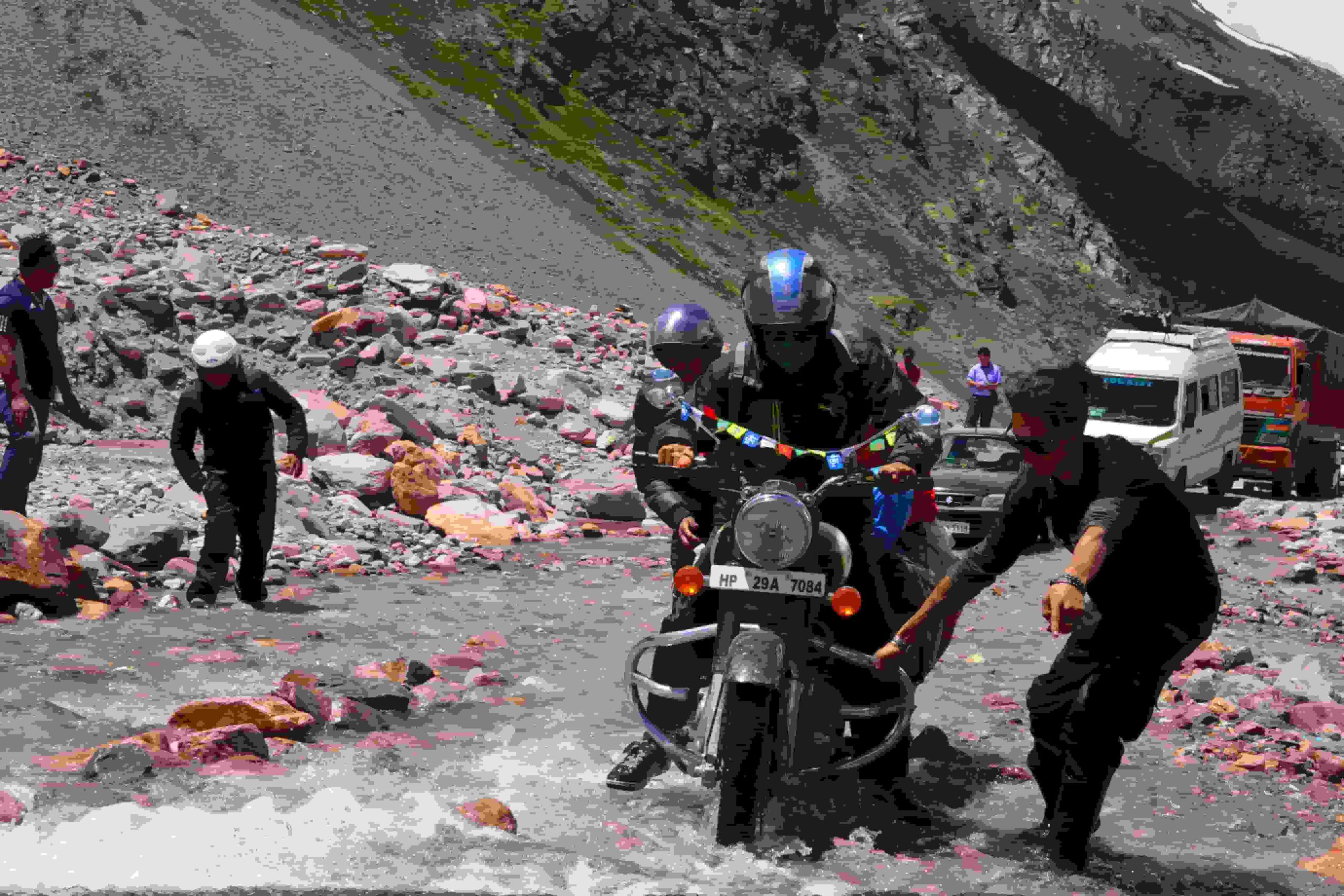
The greatest difficulty is therefore often environmental rather than technical.
What changes when you ride at 5,798 metres?
Altitude affects both the rider and the motorcycle. For the rider, fatigue develops more quickly and physical exertion feels considerably harder. For the motorcycle, thinner air affects engine performance, while cold temperatures create additional mechanical considerations. Fuel planning, mechanical support, spare parts, tyre condition, luggage, communications, weather monitoring and emergency arrangements all become part of the planning process.
What permits do you need?
This is one area where travellers should never rely on an old blog post. Ladakh’s permit and access framework can change, particularly in sensitive border regions. The Ladakh administration maintains an online tourist management system for applicable tourism formalities and fees, and has also been reviewing the Protected Area Permit and Restricted Area Permit framework for foreign travellers.
There is no responsible one-line answer such as “you only need X permit”. Requirements can depend on nationality, current notified restricted areas, route, destination, applicable tourist fees, administrative orders and security restrictions. For international travellers the situation requires additional care, because the PAP/RAP framework and how permits are issued and verified in sensitive eastern and northern regions is under active review. Confirm the current position immediately before your journey rather than relying on information published months or years earlier.
When is the best time to ride?
The practical riding season is generally concentrated in the warmer months when high-altitude roads are accessible, but exact opening and closing dates vary year to year. Snowfall, road clearance, weather and local administrative decisions all affect access. The better question is not which month, but: when are the route, weather, permits and road conditions suitable for this specific expedition? A responsible operator checks conditions rather than promising that a particular date will always work.
What should you carry?
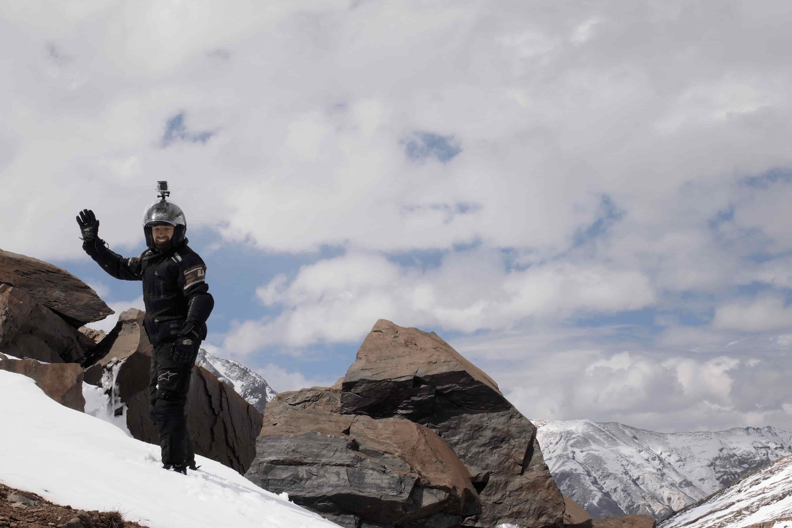
The exact equipment depends on the wider itinerary, but riders should prepare for a serious high-altitude mountain environment:
- Properly insulated riding layers
- Waterproof and windproof outer layers
- Warm gloves
- Suitable riding boots
- Eye protection
- Thermal base layers
- Sun protection
- Hydration
- Personal medication
- Essential documents and identification
- Communication arrangements
- Emergency supplies
Prepare for the conditions you might encounter, not just the weather forecast you see in Leh.
Why a support vehicle matters
A motorcycle expedition in remote Ladakh should not be planned like a solo ride through an ordinary road network. A support vehicle provides additional capacity for luggage, equipment, spare parts, first-aid supplies, emergency support, rider assistance and mechanical contingencies. The exact support system should be defined by the operator and the route. On our longer motorcycle expeditions, the approach is built around experienced road leadership, mechanical support and logistics appropriate to the journey.
Riding Umling La as Part of an Expedition
It is about more than the summit sign
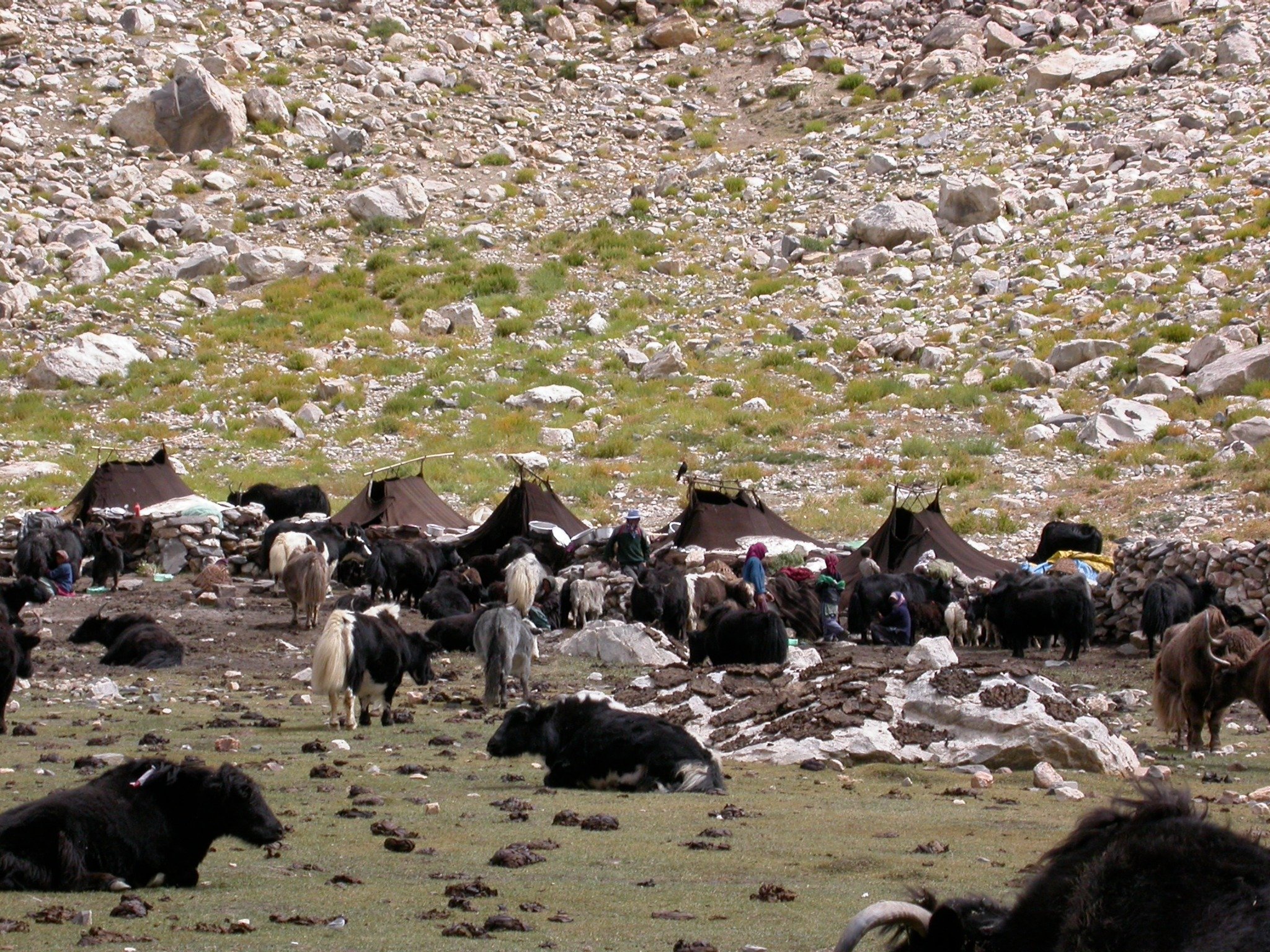
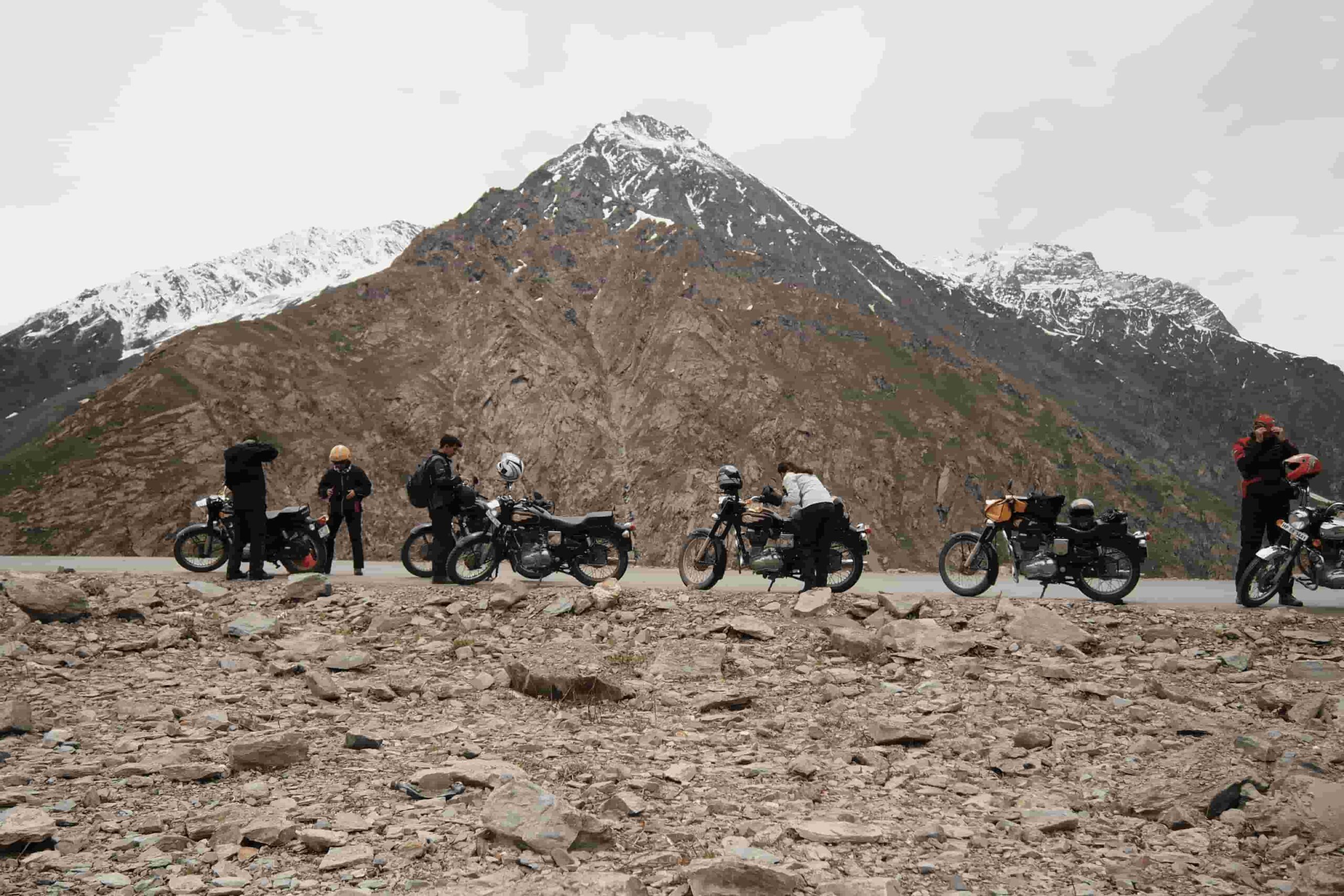
The famous photograph at the top is only one moment of the experience. The more memorable part of the journey is often the landscape leading there. Changthang presents a dramatically different Himalayan environment from the green valleys around Manali or the more populated areas around Leh. The landscape becomes broader, drier and more exposed, with enormous open spaces, high mountain ridges, remote settlements and a sense of distance that is difficult to experience on conventional tourist routes.
Responsible riding in Changthang
Eastern Ladakh is an environmentally and culturally sensitive region. Stay on appropriate roads and tracks, avoid unnecessary off-road riding, carry all waste back with you, and respect local communities and cultural sites. Do not disturb wildlife or approach animals for photographs. A successful Himalayan expedition should leave the landscape with as little impact as possible.
Is this ride suitable for every rider?
No. The motorcycle itself is not necessarily the most difficult part. The combination of altitude, long riding days, cold, weather, remoteness and limited infrastructure is what makes the journey demanding. Riders should be comfortable with long days in the saddle, changing mountain-road conditions, high-altitude environments, cold and wind, remote travel, following expedition procedures and adapting to weather and road changes. Previous Himalayan riding experience is highly valuable — a Ladakh motorcycle expedition or a Nepal–Tibet journey is useful preparation.
Umling La inside a longer Himalayan expedition
We do not look at Umling La as an isolated photo opportunity. It is one component of a much larger Himalayan riding experience. Our expeditions are designed around the realities of long-distance riding in remote mountain environments, combining experienced road leadership, mechanical support, logistics and route planning.
For riders looking for a longer journey, our Himalayan Legends 20-day ride connects major Himalayan regions including Spiti, Zanskar, Ladakh and Changthang, with Umling La at 5,798 metres as the highest point of the expedition. That structure lets riders experience the changing character of the Himalayas rather than travelling directly to one high-altitude road and returning.
The real attraction of Umling La
Umling La is famous because of a number on a signboard. But the number alone does not explain why riders travel across Ladakh to reach it. The real experience is the journey into eastern Ladakh: the transition from Leh towards Changthang, the increasingly remote landscape, the high-altitude roads, the long riding days and the knowledge that you are travelling through one of the most extreme road environments in the Himalayas.
The road record may change again as new high-altitude roads are built — it already has. The landscape does not. For riders who approach it with preparation, respect for altitude and an understanding of the region, Umling La becomes much more than a bucket-list photograph. It becomes part of a genuine Himalayan motorcycle expedition.
Planning a ride to Umling La? Talk to our team about current access, route structure and dates.
Frequently asked questions
Umling La is recorded by Guinness World Records at 5,798.251 metres (19,024 feet), measured at the pass on the Chisumle–Demchok road in eastern Ladakh.
Not since October 2025. The Border Roads Organisation opened the Likaru–Mig La–Fukche road over Mig La at about 5,913 metres (19,400 feet), roughly 370 feet higher. Umling La remains one of the highest motorable roads in the world.
Umling La is in eastern Ladakh’s Changthang region, associated with the Chisumle–Demchok road and the Hanle area.
Yes, when the route is open and the applicable access requirements are met. Road and administrative conditions change, so current access should be confirmed before departure.
A common expedition approach is Leh → Upshi → Chumathang → Nyoma → Loma → Hanle, followed by the Hanle–Umling La section. Alternative eastern Ladakh approaches may be possible depending on current permissions and road conditions.
This is not a sensible expedition design for most riders. The combination of distance and altitude makes it preferable to reach eastern Ladakh progressively and use Hanle as a staging point before attempting the pass.
Requirements depend on nationality, route and current regulations. Ladakh’s permit framework for sensitive eastern areas is under administrative review, particularly for foreign travellers. Always confirm current requirements immediately before travelling.
Access for foreign travellers depends on the current Protected Area and Restricted Area framework and the specific route. Requirements and permitted areas change, so international riders should have their operator verify the position before booking.
The ride is generally planned during the accessible Ladakh riding season, but opening dates and conditions vary with snow, weather and road clearance. Confirm the route close to departure.
The principal challenges are extreme altitude, weather, remoteness and limited infrastructure. Appropriate acclimatisation, route planning, weather monitoring, support and the willingness to turn back when conditions require it all matter.


